If you plan on using PinpointAPRS with no Internet connection and want to be able to see your maps, I have a little undocumented tip for you. The map files are cached on your local computer!
To get to the file, allow hidden files in Explorer to be seen so that you can view the following folder: C:\Users\{your windows account}\AppData\Local\GMap.NET\TileDBv5\en – the file is named “Data.gmdb”. ( You can even copy that file to another computer).
How to populate the map cache file
- Turn off your radio and TNC if you have those running.
- Set your home position manually. (Hold shift, click a spot on the map, click “Set as My Position”.)
- In Options > APRS, turn off “Enable APRS Beaconing”.
- In Options > APRS-IS, leave all the boxes unchecked except the radio button next to “Receive”. Select the APRS-IS closest to you. Set the Receive Range filter to the area you want to cache (miles radius from your marked location). Leave custom filter blank. Don’t igate anything.
- In Options > Map, Check the box next to “Center the map on received APRS position reports” and select the type of map you want to cache (I like Google TerrainMap).
- Now in the map view, zoom to the level you want to cache. There are 25 zoom levels – zoom level 1 is the whole world and level 25 is as close as it’s going to get. Zoom level 17 gets you a good amount of detail. If you choose too narrow of a space, you’ll probably end up with blank spots when you’re working offline.
- Leave the program running for a few hours in full screen with APRS-IS connected.
- Monitor the data file size. If it doesn’t seem to be growing, you can adjust the zoom settings and/or radius to get more info.
- Test the cached maps by turning off the Internet connection on your computer. You’ll notice as you zoom out that areas of the map outside the cached maps will not be visible.
- Repeat the above steps as needed until you have the cached maps you need.
How long does it take?
That really depends upon how many station reports are flowing into your data stream. If you leave the computer running overnight, that should be more than enough time. If you live in an area that doesn’t have much APRS traffic, this automated method of collecting maps probably isn’t going to work well for you. Instead you’ll probably need to just move around the map manually to get the tiles cached.
How big is the file?
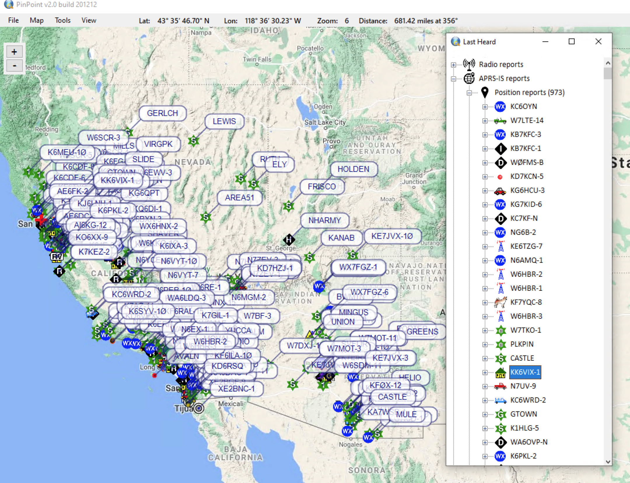
My file is approximately 1.2 GB. I’ve captured a 500 mile radius, about 973 unique stations, with a file that size.
SIDENOTE ABOUT SYSTEM RESOURCES
The bigger the resolution you’re running and the larger the radius, the more traffic you’ll have coming in, and the more RAM this program is going to use as map data flows in. If the program is continuously locking up, try a smaller radius. You can move your home location around and capture different spots of the map.